
Sabina Alta topographic map
Interactive map
Click on the map to display elevation.
About this map
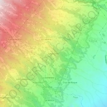
Name: Sabina Alta topographic map, elevation, terrain.
Average elevation: 585 m
Minimum elevation: 149 m
Maximum elevation: 1,147 m
Other topographic maps
Click on a map to view its topography, its elevation and its terrain.
Fuente Nueva
Fuente Nueva, Fasnia, Santa Cruz de Tenerife, Canary Islands, 38579, Spain
Average elevation: 863 m