
El Manchar topographic map
Interactive map
Click on the map to display elevation.
About this map
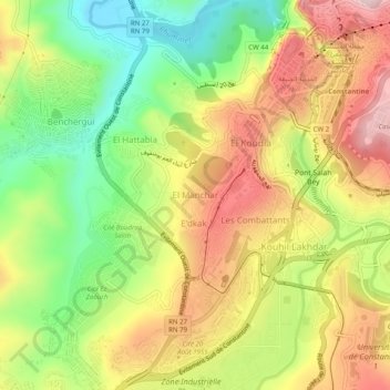
Name: El Manchar topographic map, elevation, terrain.
Average elevation: 532 m
Minimum elevation: 355 m
Maximum elevation: 716 m
Other topographic maps
Click on a map to view its topography, its elevation and its terrain.
Ben Abdelmalek
Algérie > Constantine > Daïra Constantine > Constantine
Ben Abdelmalek, Constantine, Daïra Constantine, Constantine, 25100, Algérie
Average elevation: 622 m