
Finiels topographic map
Interactive map
Click on the map to display elevation.
About this map
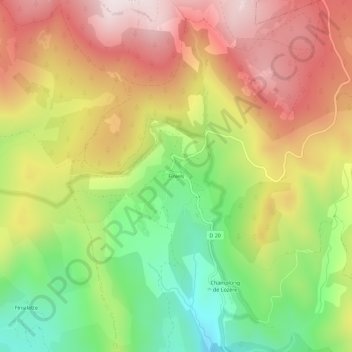
Name: Finiels topographic map, elevation, terrain.
Average elevation: 1,362 m
Minimum elevation: 1,031 m
Maximum elevation: 1,682 m
Other topographic maps
Click on a map to view its topography, its elevation and its terrain.
Fraissinet-de-Lozère
France > Occitania > Lozère > Pont de Montvert - Sud Mont Lozère
Fraissinet-de-Lozère, Pont de Montvert - Sud Mont Lozère, Florac, Lozère, Occitania, Metropolitan France, 48220, France
Average elevation: 1,226 m