
Tak Province topographic map
Interactive map
Click on the map to display elevation.
About this map
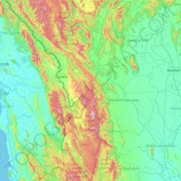
Name: Tak Province topographic map, elevation, terrain.
Location: Tak Province, Thailand (15.18070 97.90983 17.83303 99.34583)
Average elevation: 303 m
Minimum elevation: -2 m
Maximum elevation: 2,063 m
Other topographic maps
Click on a map to view its topography, its elevation and its terrain.
Phra Borom Maha Ratchawang Subdistrict
Thailand > Bangkok > Phra Nakhon District > Bangkok
Average elevation: 4 m