
Zomergem topographic map
Interactive map
Click on the map to display elevation.
About this map
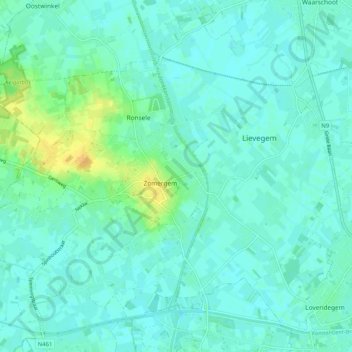
Name: Zomergem topographic map, elevation, terrain.
Average elevation: 8 m
Minimum elevation: 2 m
Maximum elevation: 28 m
Other topographic maps
Click on a map to view its topography, its elevation and its terrain.
Vinderhoute
België > Oost-Vlaanderen > Gent > Lievegem
Vinderhoute, Lievegem, Gent, Oost-Vlaanderen, Vlaanderen, 9921, België
Average elevation: 6 m