
Banyoles topographic map
Interactive map
Click on the map to display elevation.
About this map
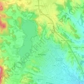
Name: Banyoles topographic map, elevation, terrain.
Location: Banyoles, Plaine de l'Estagne, Gérone, Catalogne, 17820, Espagne (42.10524 2.74675 42.14386 2.80593)
Average elevation: 186 m
Minimum elevation: 115 m
Maximum elevation: 330 m
Other topographic maps
Click on a map to view its topography, its elevation and its terrain.
Esponellà
Espagne > Catalogne > Plaine de l'Estagne
Esponellà, Plaine de l'Estagne, Gérone, Catalogne, Espagne
Average elevation: 177 m