
Nagrota Bagwan topographic map
Interactive map
Click on the map to display elevation.
About this map
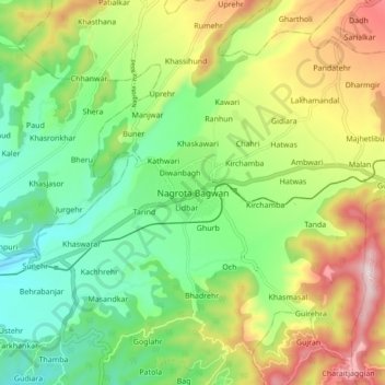
Name: Nagrota Bagwan topographic map, elevation, terrain.
Location: Nagrota Bagwan, Kangra, Himachal Pradesh, India (32.07159 76.33874 32.15159 76.41874)
Average elevation: 915 m
Minimum elevation: 726 m
Maximum elevation: 1,211 m