
Hahatonka topographic map
Interactive map
Click on the map to display elevation.
About this map
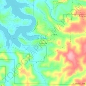
Name: Hahatonka topographic map, elevation, terrain.
Location: Hahatonka, Camden County, Missouri, USA (37.95206 -92.78923 37.99206 -92.74923)
Average elevation: 248 m
Minimum elevation: 197 m
Maximum elevation: 338 m