
Hortelã topographic map
Interactive map
Click on the map to display elevation.
About this map
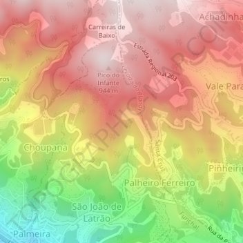
Name: Hortelã topographic map, elevation, terrain.
Location: Hortelã, São Gonçalo, Funchal, Madeira, 9060-255, Portugal (32.66150 -16.88268 32.68150 -16.86268)
Average elevation: 688 m
Minimum elevation: 297 m
Maximum elevation: 950 m