
Vila-real topographic map
Interactive map
Click on the map to display elevation.
About this map
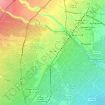
Name: Vila-real topographic map, elevation, terrain.
Average elevation: 42 m
Minimum elevation: 0 m
Maximum elevation: 106 m
Other topographic maps
Click on a map to view its topography, its elevation and its terrain.
Fuentes de Ayódar
Espanha > Comunidade Valenciana > Castelló / Castellón
Fuentes de Ayódar, l'Alt Millars, Castelló / Castellón, Comunidade Valenciana, 12225, Espanha
Average elevation: 645 m
Castelló de la Plana
Espanha > Comunidade Valenciana > Castelló / Castellón
Castelló de la Plana, la Plana Alta, Castelló / Castellón, Comunidade Valenciana, Espanha
Average elevation: 216 m
Altura
Espanha > Comunidade Valenciana > Castelló / Castellón
Altura, l'Alt Palància, Castelló / Castellón, Comunidade Valenciana, Espanha
Average elevation: 524 m