
Bölling topographic map
Interactive map
Click on the map to display elevation.
About this map
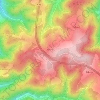
Name: Bölling topographic map, elevation, terrain.
Location: Bölling, Eilpe/Dahl, Hagen, Nordrhein-Westfalen, Deutschland (51.29151 7.55853 51.29330 7.56192)
Average elevation: 346 m
Minimum elevation: 186 m
Maximum elevation: 441 m