
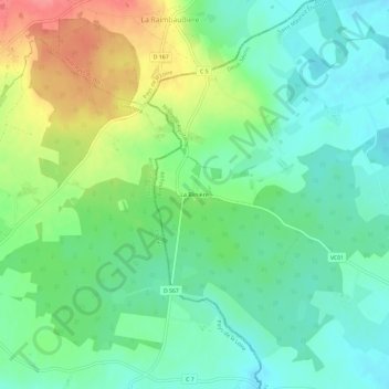
La Blinière topographic map
Interactive map
Click on the map to display elevation.
About this map
Name: La Blinière topographic map, elevation, terrain.
Average elevation: 148 m
Minimum elevation: 121 m
Maximum elevation: 198 m
Other topographic maps
Click on a map to view its topography, its elevation and its terrain.
Étusson
France > Nouvelle-Aquitaine > Deux-Sèvres > Saint Maurice Étusson
Étusson, Saint Maurice Étusson, Bressuire, Deux-Sèvres, Nouvelle-Aquitaine, France métropolitaine, 79150, France
Average elevation: 134 m
Retord
France > Nouvelle-Aquitaine > Deux-Sèvres > Saint Maurice Étusson > Retord
Retord, Saint-Maurice-la-Fougereuse, Saint Maurice Étusson, Bressuire, Deux-Sèvres, Nouvelle-Aquitaine, France métropolitaine, 79150, France
Average elevation: 143 m