
Catur topographic map
Interactive map
Click on the map to display elevation.
About this map
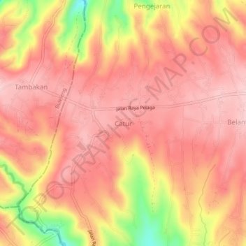
Name: Catur topographic map, elevation, terrain.
Location: Catur, Bangli, Bali, Lesser Sunda Islands, Indonesia (-8.24646 115.22950 -8.20646 115.26950)
Average elevation: 1,208 m
Minimum elevation: 1,052 m
Maximum elevation: 1,271 m
Other topographic maps
Click on a map to view its topography, its elevation and its terrain.