
Brye topographic map
Interactive map
Click on the map to display elevation.
About this map
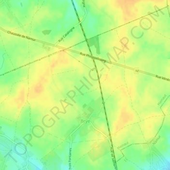
Name: Brye topographic map, elevation, terrain.
Location: Brye, Fleurus, Charleroi, Hainaut, Wallonie, 6222, Belgique (50.51745 4.54231 50.54231 4.58049)
Average elevation: 152 m
Minimum elevation: 134 m
Maximum elevation: 162 m
Other topographic maps
Click on a map to view its topography, its elevation and its terrain.
Le Vieux Campinaire
Belgique > Hainaut > Charleroi > Fleurus
Le Vieux Campinaire, Fleurus, Charleroi, Hainaut, Wallonie, 6220, Belgique
Average elevation: 164 m