
Ashley Retreat topographic map
Interactive map
Click on the map to display elevation.
About this map
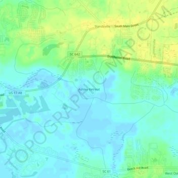
Name: Ashley Retreat topographic map, elevation, terrain.
Average elevation: 11 m
Minimum elevation: 3 m
Maximum elevation: 24 m
Other topographic maps
Click on a map to view its topography, its elevation and its terrain.
Ashborough
United States > South Carolina > Dorchester County > Summerville
Ashborough, Summerville, Dorchester County, South Carolina, 29485, United States
Average elevation: 9 m
Westoe
United States > South Carolina > Dorchester County > Summerville
Westoe, Summerville, Dorchester County, South Carolina, United States
Average elevation: 7 m