
Thank you for supporting this site ❤️
Make a donation
Make a donation
Senge topographic map
Click on the map to display elevation.
Thank you for supporting this site ❤️
Make a donation
Make a donation
About this map
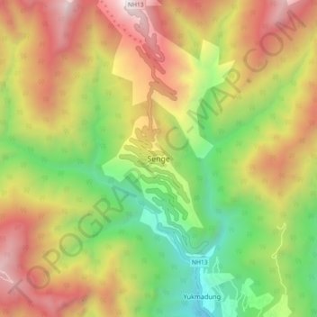
Name: Senge topographic map, elevation, terrain.
Location: Senge, Dirang ADC, West Kameng, Arunachal Pradesh, India (27.41621 92.07212 27.49621 92.15212)
Average elevation: 3,055 m
Minimum elevation: 2,044 m
Maximum elevation: 4,204 m
Thank you for supporting this site ❤️
Make a donation
Make a donation
Other topographic maps
Click on a map to view its topography, its elevation and its terrain.