
Cheneux topographic map
Interactive map
Click on the map to display elevation.
About this map
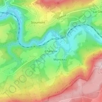
Name: Cheneux topographic map, elevation, terrain.
Location: Cheneux, Verviers, Luik, Wallonië, 4987, België (50.37571 5.79647 50.41571 5.83647)
Average elevation: 322 m
Minimum elevation: 188 m
Maximum elevation: 516 m