
Thank you for supporting this site ❤️
Make a donation
Make a donation
Western Rukum District topographic map
Click on the map to display elevation.
Thank you for supporting this site ❤️
Make a donation
Make a donation
About this map
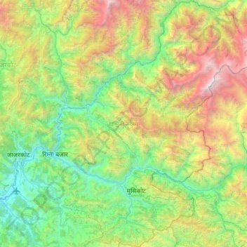
Name: Western Rukum District topographic map, elevation, terrain.
Location: Western Rukum District, Karnali Province, 22000, Nepal (28.52095 82.18334 28.99184 82.70140)
Average elevation: 2,181 m
Minimum elevation: 665 m
Maximum elevation: 5,856 m
Thank you for supporting this site ❤️
Make a donation
Make a donation
Other topographic maps
Click on a map to view its topography, its elevation and its terrain.
Thank you for supporting this site ❤️
Make a donation
Make a donation
Thank you for supporting this site ❤️
Make a donation
Make a donation