
Kodiak Island topographic map
Interactive map
Click on the map to display elevation.
About this map
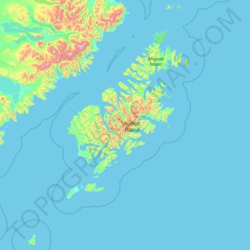
Name: Kodiak Island topographic map, elevation, terrain.
Location: Kodiak Island, Alaska, United States of America (55.69991 -156.90315 59.01789 -151.69051)
Average elevation: 84 m
Minimum elevation: -1 m
Maximum elevation: 2,289 m
Other topographic maps
Click on a map to view its topography, its elevation and its terrain.
Northwest Arctic
United States of America > Alaska
Northwest Arctic, Alaska, United States of America
Average elevation: 296 m
Southeast Fairbanks
United States of America > Alaska > Eagle
Southeast Fairbanks, Old Camp Road, Eagle, Unorganized Borough, Alaska, 99738, United States of America
Average elevation: 856 m
Denali
United States of America > Alaska
Denali, Alaska, United States of America
Average elevation: 5,546 m
North Slope
United States of America > Alaska
North Slope, Alaska, United States of America
Average elevation: 214 m