
Ras el Anaçer topographic map
Interactive map
Click on the map to display elevation.
About this map
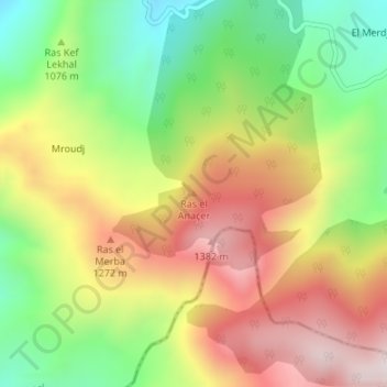
Name: Ras el Anaçer topographic map, elevation, terrain.
Location: Ras el Anaçer, Erraguene, daïra Ziama Mansouriah, Jijel, Algérie (36.55704 5.61538 36.55714 5.61548)
Average elevation: 1,077 m
Minimum elevation: 755 m
Maximum elevation: 1,422 m