
Seez topographic map
Interactive map
Click on the map to display elevation.
About this map
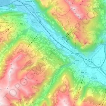
Name: Seez topographic map, elevation, terrain.
Location: Seez, Mels, Wahlkreis Sarganserland, St. Gallen, Switzerland (46.99094 9.29812 47.12066 9.41836)
Average elevation: 1,203 m
Minimum elevation: 418 m
Maximum elevation: 2,429 m