
Phalat topographic map
Interactive map
Click on the map to display elevation.
About this map
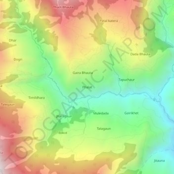
Name: Phalat topographic map, elevation, terrain.
Location: Phalat, Kuse-03, Kuse, Jajarkot, Karnali Province, Nepal (28.82145 82.07465 28.86145 82.11465)
Average elevation: 1,855 m
Minimum elevation: 1,289 m
Maximum elevation: 2,556 m
Other topographic maps
Click on a map to view its topography, its elevation and its terrain.