
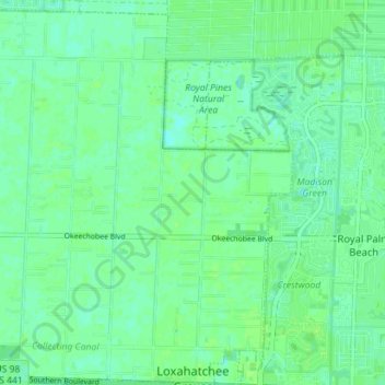
Loxahatchee Groves topographic map
Interactive map
Click on the map to display elevation.
About this map
Name: Loxahatchee Groves topographic map, elevation, terrain.
Average elevation: 9 m
Minimum elevation: 4 m
Maximum elevation: 12 m
The area now known as Loxahatchee Groves was originally a portion of the 2,000,000 acres (8,100 km2) of land purchased by the Southern States Land and Timber Company in 1902. After the West Palm Beach Canal (C-51), which connected Lake Okeechobee at Canal Point to West Palm Beach, was completed in 1917, George Frederick Bensel, the Southern States sales manager, envisioned a "waterfront" farming community along the canal. Bensel, and company engineer Torvald Garfield "T. G." Thorgesen, created the first topographical map of Loxahatchee Groves during the following three years. Bensel, Thorgesen, and others then established the Palm Beach Loxahatchee Company, and bought 6,500 acres (26 km2) from the Southern States Land and Timber Company, naming the land "Loxahatchee Farms". The Palm Beach Loxahatchee Company built almost 30 mi (48 km) of canals and roads, which were to be maintained by the Loxahatchee Groves Drainage District, that now is known as the Loxahatchee Groves Water Control District.
Other topographic maps
Click on a map to view its topography, its elevation and its terrain.
Lake Worth Beach
United States > Florida > Palm Beach County
Lake Worth Beach, Palm Beach County, Florida, 33460, United States
Average elevation: 6 m
Boynton Beach
United States > Florida > Palm Beach County
Boynton Beach, Palm Beach County, Florida, United States
Average elevation: 5 m
Lake Osborne
United States > Florida > Palm Beach County > Palm Springs
Lake Osborne, Palm Springs, Palm Beach County, Florida, United States
Average elevation: 8 m
Palm Beach Gardens
United States > Florida > Palm Beach County
Palm Beach Gardens, Palm Beach County, Florida, United States
Average elevation: 6 m
Singer Island
United States > Florida > Palm Beach County > Riviera Beach
Singer Island, Riviera Beach, Palm Beach County, Florida, 33404, United States
Average elevation: 3 m
Jupiter
United States > Florida > Palm Beach County
Jupiter, Palm Beach County, Florida, 33458, United States
Average elevation: 4 m
West Palm Beach
United States > Florida > Palm Beach County
West Palm Beach, Palm Beach County, Florida, United States
Average elevation: 4 m
Ridge Road
United States > Florida > Palm Beach County > Jupiter
Ridge Road, Jupiter, Palm Beach County, Florida, 33477, United States
Average elevation: 4 m
Juno Beach
United States > Florida > Palm Beach County
Juno Beach, Palm Beach County, Florida, United States
Average elevation: 3 m
Aberdeen
United States > Florida > Palm Beach County
Aberdeen, Palm Beach County, Florida, 33437, United States
Average elevation: 9 m
North Palm Beach
United States > Florida > Palm Beach County
North Palm Beach, Palm Beach County, Florida, 33403, United States
Average elevation: 6 m
Delray Beach
United States > Florida > Palm Beach County
Delray Beach, Palm Beach County, Florida, United States
Average elevation: 6 m
Boca Raton
United States > Florida > Palm Beach County
Boca Raton, Palm Beach County, Florida, United States
Average elevation: 5 m
Tequesta
United States > Florida > Palm Beach County
Tequesta, Palm Beach County, Florida, United States
Average elevation: 4 m
Wellington
United States > Florida > Palm Beach County
Wellington, Palm Beach County, Florida, United States
Average elevation: 8 m
Boca Raton
United States > Florida > Palm Beach County > Boca Raton
Boca Raton, Palm Beach County, Florida, 33432, United States
Average elevation: 4 m
Harbor East
United States > Florida > Palm Beach County > Boca Raton
Harbor East, Boca Raton, Palm Beach County, Florida, 33431, United States
Average elevation: 4 m
Chapel Hill
United States > Florida > Palm Beach County > Boynton Beach
Chapel Hill, Boynton Beach, Palm Beach County, Florida, 33435, United States
Average elevation: 7 m
Golden Lakes
United States > Florida > Palm Beach County > Golden Lakes
Golden Lakes, Palm Beach County, Florida, United States
Average elevation: 9 m
North Palm Beach
United States > Florida > Palm Beach County
North Palm Beach, Palm Beach County, Florida, 33408, United States
Average elevation: 4 m
Jupiter Farms Community Park
United States > Florida > Palm Beach County
Jupiter Farms Community Park, Palm Beach County, Florida, United States
Average elevation: 8 m
Pence Park
United States > Florida > Palm Beach County > Boynton Beach
Pence Park, Boynton Beach, Palm Beach County, Florida, United States
Average elevation: 7 m
Highland Beach
United States > Florida > Palm Beach County
Highland Beach, Palm Beach County, Florida, United States
Average elevation: 4 m
Tropic Isle
United States > Florida > Palm Beach County > Delray Beach
Tropic Isle, Delray Beach, Palm Beach County, Florida, 33483, United States
Average elevation: 5 m
Royal Oak Hills
United States > Florida > Palm Beach County > Boca Raton
Royal Oak Hills, Boca Raton, Palm Beach County, Florida, 33432, United States
Average elevation: 7 m
Lake Clarke Shores
United States > Florida > Palm Beach County
Lake Clarke Shores, Palm Beach County, Florida, United States
Average elevation: 8 m
Jupiter Inlet Colony
United States > Florida > Palm Beach County > Jupiter Inlet Colony
Jupiter Inlet Colony, Palm Beach County, Florida, United States
Average elevation: 3 m
Mangonia Park
United States > Florida > Palm Beach County
Mangonia Park, Palm Beach County, Florida, United States
Average elevation: 8 m
Greenacres
United States > Florida > Palm Beach County
Greenacres, Palm Beach County, Florida, United States
Average elevation: 9 m
Morikami Museum and Japanese Gardens
United States > Florida > Palm Beach County > Delray Beach
Morikami Museum and Japanese Gardens, Delray Beach, Palm Beach County, Florida, 33446, United States
Average elevation: 9 m
Loxahatchee Groves
United States > Florida > Palm Beach County > Loxahatchee Groves
Loxahatchee Groves, Palm Beach County, Florida, 33411:33415, United States
Average elevation: 9 m
Seminole Manor
United States > Florida > Palm Beach County > Seminole Manor
Seminole Manor, Palm Beach County, Florida, United States
Average elevation: 8 m
Atlantis
United States > Florida > Palm Beach County
Atlantis, Palm Beach County, Florida, United States
Average elevation: 8 m
Caribbean Key
United States > Florida > Palm Beach County > Boca Raton > Caribbean Key
Caribbean Key, Boca Raton, Palm Beach County, Florida, 33487, United States
Average elevation: 5 m
Riviera Beach
United States > Florida > Palm Beach County
Riviera Beach, Palm Beach County, Florida, 33404, United States
Average elevation: 5 m
Paradise Port
United States > Florida > Palm Beach County > Paradise Port
Paradise Port, Palm Beach County, Florida, 33477, United States
Average elevation: 6 m
Boynton Beach
United States > Florida > Palm Beach County > Boynton Beach
Boynton Beach, Palm Beach County, Florida, 33435, United States
Average elevation: 4 m
Lantana
United States > Florida > Palm Beach County
Lantana, Palm Beach County, Florida, United States
Average elevation: 5 m
High Point
United States > Florida > Palm Beach County > Delray Beach
High Point, Delray Beach, Palm Beach County, Florida, United States
Average elevation: 9 m
Ocean Ridge
United States > Florida > Palm Beach County
Ocean Ridge, Palm Beach County, Florida, United States
Average elevation: 4 m
Palm Beach
United States > Florida > Palm Beach County
Palm Beach, Palm Beach County, Florida, United States
Average elevation: 4 m
Paradise Palms
United States > Florida > Palm Beach County > Boca Raton
Paradise Palms, Boca Raton, Palm Beach County, Florida, 33486, United States
Average elevation: 8 m
Pelican Lake
United States > Florida > Palm Beach County
Pelican Lake, Palm Beach County, Florida, 33439, United States
Average elevation: 4 m
Belle Glade
United States > Florida > Palm Beach County > Belle Glade
Belle Glade, Palm Beach County, Florida, 33430, United States
Average elevation: 4 m
Manalapan
United States > Florida > Palm Beach County
Manalapan, Palm Beach County, Florida, United States
Average elevation: 3 m
Hypoluxo
United States > Florida > Palm Beach County
Hypoluxo, Palm Beach County, Florida, United States
Average elevation: 5 m
Royal Palm Beach
United States > Florida > Palm Beach County
Royal Palm Beach, Palm Beach County, Florida, 33411, United States
Average elevation: 9 m
Pahokee
United States > Florida > Palm Beach County
Pahokee, Palm Beach County, Florida, 33476, United States
Average elevation: 3 m
Lake Park
United States > Florida > Palm Beach County > Lake Park
Lake Park, Palm Beach County, Florida, 33403, United States
Average elevation: 6 m