
Freehold topographic map
Interactive map
Click on the map to display elevation.
Freehold
Freehold has an elevation of 174 feet (53 m) above sea level at its center.
About this map
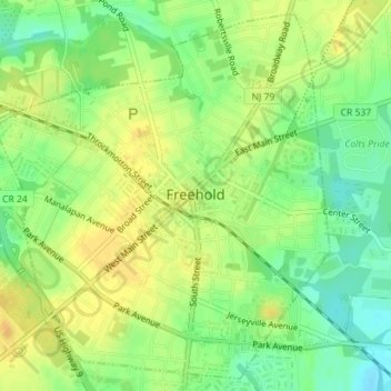
Name: Freehold topographic map, elevation, terrain.
Location: Freehold, Monmouth County, New Jersey, United States (40.24737 -74.29201 40.27253 -74.26161)
Average elevation: 53 m
Minimum elevation: 37 m
Maximum elevation: 64 m