Unter den Eichen topographic map
Interactive map
Click on the map to display elevation.
About this map
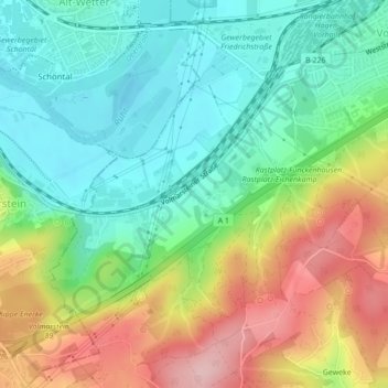
Name: Unter den Eichen topographic map, elevation, terrain.
Average elevation: 147 m
Minimum elevation: 78 m
Maximum elevation: 263 m

Click on the map to display elevation.
Name: Unter den Eichen topographic map, elevation, terrain.
Average elevation: 147 m
Minimum elevation: 78 m
Maximum elevation: 263 m