
Waterloo topographic map
Interactive map
Click on the map to display elevation.
About this map
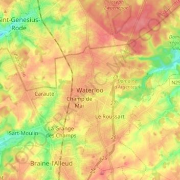
Name: Waterloo topographic map, elevation, terrain.
Location: Waterloo, Nivelles, Walloon Brabant, Wallonia, 1410, Belgium (50.67537 4.35637 50.75537 4.43637)
Average elevation: 110 m
Minimum elevation: 60 m
Maximum elevation: 149 m
Other topographic maps
Click on a map to view its topography, its elevation and its terrain.
Vert Coucou
Belgium > Walloon Brabant > Nivelles > Waterloo
Vert Coucou, Waterloo, Nivelles, Walloon Brabant, Wallonia, 1410, Belgium
Average elevation: 111 m