
Manisa topographic map
Interactive map
Click on the map to display elevation.
About this map
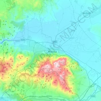
Name: Manisa topographic map, elevation, terrain.
Location: Manisa, Şehzadeler, Manisa, Aegean Region, 45020, Turkey (38.45258 27.27340 38.77258 27.59340)
Average elevation: 253 m
Minimum elevation: 17 m
Maximum elevation: 1,500 m
Other topographic maps
Click on a map to view its topography, its elevation and its terrain.
Şehzadeler
Şehzadeler, Manisa, Aegean Region, 45020, Turkey
Average elevation: 296 m