
Thank you for supporting this site ❤️
Make a donation
Make a donation
Mount Vernon topographic map
Click on the map to display elevation.
Thank you for supporting this site ❤️
Make a donation
Make a donation
About this map
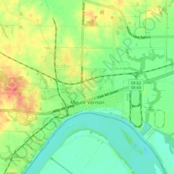
Name: Mount Vernon topographic map, elevation, terrain.
Location: Mount Vernon, Posey County, Indiana, United States (37.92319 -87.92754 37.95104 -87.85067)
Average elevation: 120 m
Minimum elevation: 100 m
Maximum elevation: 150 m
Thank you for supporting this site ❤️
Make a donation
Make a donation
Other topographic maps
Click on a map to view its topography, its elevation and its terrain.