
Castel San Pietro topographic map
Interactive map
Click on the map to display elevation.
About this map
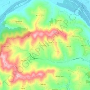
Name: Castel San Pietro topographic map, elevation, terrain.
Location: Castel San Pietro, Camino, Alessandria, Piemonte, 13039, Italia (45.13816 8.24841 45.17816 8.28841)
Average elevation: 225 m
Minimum elevation: 123 m
Maximum elevation: 369 m