
Durham County topographic map
Interactive map
Click on the map to display elevation.
About this map
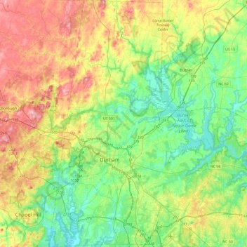
Name: Durham County topographic map, elevation, terrain.
Location: Durham County, North Carolina, United States (35.86322 -79.01628 36.23931 -78.69929)
Average elevation: 128 m
Minimum elevation: 67 m
Maximum elevation: 237 m
Other topographic maps
Click on a map to view its topography, its elevation and its terrain.