
Amity topographic map
Interactive map
Click on the map to display elevation.
About this map
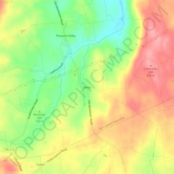
Name: Amity topographic map, elevation, terrain.
Average elevation: 162 m
Minimum elevation: 109 m
Maximum elevation: 208 m
Other topographic maps
Click on a map to view its topography, its elevation and its terrain.
Zionhill
United States > Pennsylvania > Bucks County > Springfield Township
Zionhill, Springfield Township, Bucks County, Pennsylvania, 18036, United States
Average elevation: 194 m
Gallows Hill
United States > Pennsylvania > Bucks County > Springfield Township
Gallows Hill, Springfield Township, Bucks County, Pennsylvania, 18930, United States
Average elevation: 167 m
Pleasant Valley
United States > Pennsylvania > Bucks County > Springfield Township
Pleasant Valley, Springfield Township, Bucks County, Pennsylvania, 18081, United States
Average elevation: 155 m
Springtown
United States > Pennsylvania > Bucks County > Springfield Township
Springtown, Springfield Township, Bucks County, Pennsylvania, 18081, United States
Average elevation: 163 m