
Ahdil topographic map
Interactive map
Click on the map to display elevation.
About this map
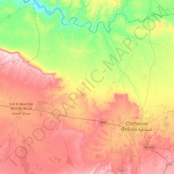
Name: Ahdil topographic map, elevation, terrain.
Average elevation: 330 m
Minimum elevation: 116 m
Maximum elevation: 558 m
Other topographic maps
Click on a map to view its topography, its elevation and its terrain.
Sidi Bouzid Arragragui
Sidi Bouzid Arragragui, Caïdat de Chichaoua, Cercle de Chichaoua, Province de Chichaoua, Marrakech-Safi, Maroc
Average elevation: 435 m