
Larhat topographic map
Interactive map
Click on the map to display elevation.
About this map
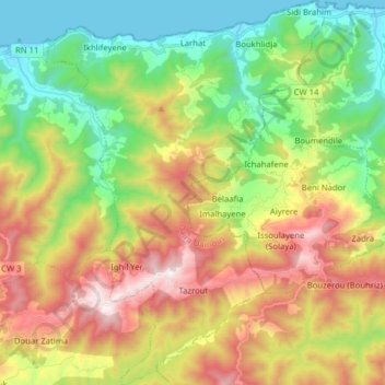
Name: Larhat topographic map, elevation, terrain.
Location: Larhat, Daïra Damous, Tipaza, Algérie (36.44406 1.74107 36.57064 1.85740)
Average elevation: 435 m
Minimum elevation: -1 m
Maximum elevation: 1,078 m