
Brandrüttel topographic map
Interactive map
Click on the map to display elevation.
About this map
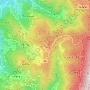
Name: Brandrüttel topographic map, elevation, terrain.
Average elevation: 687 m
Minimum elevation: 307 m
Maximum elevation: 1,126 m
Other topographic maps
Click on a map to view its topography, its elevation and its terrain.
Hohritt
Deutschland > Baden-Württemberg > Ortenaukreis > Sasbachwalden > Hohritt
Hohritt, Sasbachwalden, Verwaltungsgemeinschaft Achern, Ortenaukreis, Baden-Württemberg, 77887, Deutschland
Average elevation: 562 m
Hornisgrinde
Deutschland > Baden-Württemberg > Ortenaukreis > Sasbachwalden
Hornisgrinde, Sasbachwalden, Verwaltungsgemeinschaft Achern, Ortenaukreis, Baden-Württemberg, 77889, Deutschland
Average elevation: 968 m