
Ragaciems topographic map
Interactive map
Click on the map to display elevation.
About this map
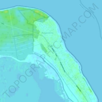
Name: Ragaciems topographic map, elevation, terrain.
Location: Ragaciems, Tukuma novads, Courland, Latvia (57.01514 23.47794 57.03379 23.50829)
Average elevation: 2 m
Minimum elevation: -1 m
Maximum elevation: 12 m
Other topographic maps
Click on a map to view its topography, its elevation and its terrain.
Engures novads
Latvia > Courland > Tukuma novads
Engures novads, Tukuma novads, Courland, Latvia
Average elevation: 23 m