
Loutteville topographic map
Interactive map
Click on the map to display elevation.
About this map
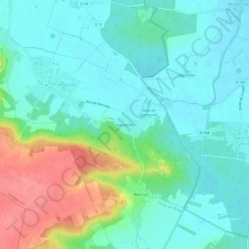
Name: Loutteville topographic map, elevation, terrain.
Average elevation: 95 m
Minimum elevation: 73 m
Maximum elevation: 152 m
Other topographic maps
Click on a map to view its topography, its elevation and its terrain.
La Padôle
France > Île-de-France > Essonne > Champcueil > La Padôle
La Padôle, Champcueil, Arrondissement d'Évry, Essonne, Île-de-France, France métropolitaine, 91750, France
Average elevation: 127 m