
Buhotina topographic map
Interactive map
Click on the map to display elevation.
About this map
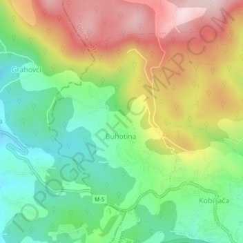
Name: Buhotina topographic map, elevation, terrain.
Average elevation: 676 m
Minimum elevation: 524 m
Maximum elevation: 879 m
Other topographic maps
Click on a map to view its topography, its elevation and its terrain.
Batura
Bosnia and Herzegovina > Federation of Bosnia and Herzegovina
Batura, Fojnica municipality, Central Bosnia Canton, Federation of Bosnia and Herzegovina, 71270, Bosnia and Herzegovina
Average elevation: 1,194 m