
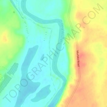
Brenda Park topographic map
Interactive map
Click on the map to display elevation.
About this map
Name: Brenda Park topographic map, elevation, terrain.
Average elevation: 23 m
Minimum elevation: 3 m
Maximum elevation: 52 m
Other topographic maps
Click on a map to view its topography, its elevation and its terrain.
Dutton
Australia > South Australia > Mid Murray Council
Dutton, Mid Murray Council, South Australia, 5356, Australia
Average elevation: 366 m
Barossa Valley District
Australia > South Australia > Mid Murray Council
Barossa Valley District, Mid Murray Council, South Australia, Australia
Average elevation: 294 m
Blanchetown
Australia > South Australia > Mid Murray Council
Blanchetown, Mid Murray Council, South Australia, 5357, Australia
Average elevation: 52 m
Sedan
Australia > South Australia > Mid Murray Council > Sedan
Sedan, Mid Murray Council, South Australia, 5353, Australia
Average elevation: 162 m