
Breitfeld topographic map
Interactive map
Click on the map to display elevation.
About this map
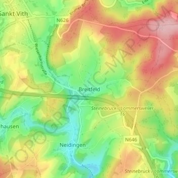
Name: Breitfeld topographic map, elevation, terrain.
Location: Breitfeld, Sankt Vith, Verviers, Luik, Wallonië, 4780, België (50.24335 6.13272 50.28335 6.17272)
Average elevation: 474 m
Minimum elevation: 398 m
Maximum elevation: 561 m
Other topographic maps
Click on a map to view its topography, its elevation and its terrain.