
Gouviães e Ucanha topographic map
Interactive map
Click on the map to display elevation.
About this map
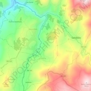
Name: Gouviães e Ucanha topographic map, elevation, terrain.
Location: Gouviães e Ucanha, Tarouca, Viseu, Portugal (41.03188 -7.76885 41.07055 -7.72093)
Average elevation: 542 m
Minimum elevation: 319 m
Maximum elevation: 794 m
Other topographic maps
Click on a map to view its topography, its elevation and its terrain.