
Latacunga topographic map
Interactive map
Click on the map to display elevation.
About this map
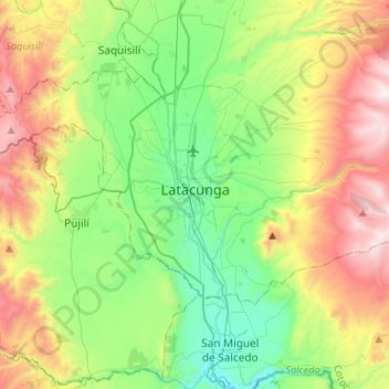
Name: Latacunga topographic map, elevation, terrain.
Location: Latacunga, Cotopaxi, Ecuador (-1.00867 -78.66718 -0.86744 -78.40152)
Average elevation: 3,114 m
Minimum elevation: 2,569 m
Maximum elevation: 4,116 m
Other topographic maps
Click on a map to view its topography, its elevation and its terrain.