
Pontedeume topographic map
Interactive map
Click on the map to display elevation.
About this map
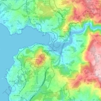
Name: Pontedeume topographic map, elevation, terrain.
Location: Pontedeume, O Eume, A Corogne, Galice, 15600, Espagne (43.36726 -8.21188 43.44726 -8.13188)
Average elevation: 119 m
Minimum elevation: -1 m
Maximum elevation: 405 m