
Colón topographic map
Interactive map
Click on the map to display elevation.
About this map
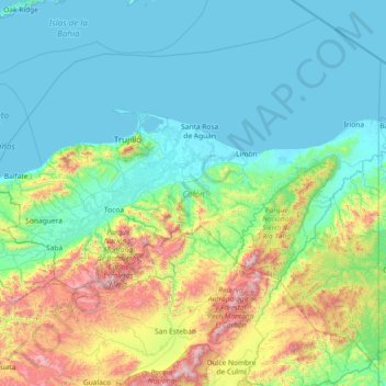
Name: Colón topographic map, elevation, terrain.
Location: Colón, Honduras (15.07098 -86.45836 16.35880 -84.99177)
Average elevation: 325 m
Minimum elevation: 0 m
Maximum elevation: 1,826 m
Other topographic maps
Click on a map to view its topography, its elevation and its terrain.