
Rochehaut topographic map
Interactive map
Click on the map to display elevation.
About this map
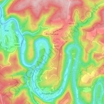
Name: Rochehaut topographic map, elevation, terrain.
Location: Rochehaut, Bouillon, Neufchâteau, Luxemburg, Wallonië, België (49.80637 4.97086 49.85692 5.02732)
Average elevation: 296 m
Minimum elevation: 182 m
Maximum elevation: 431 m