
Fulgencio Yegros topographic map
Interactive map
Click on the map to display elevation.
About this map
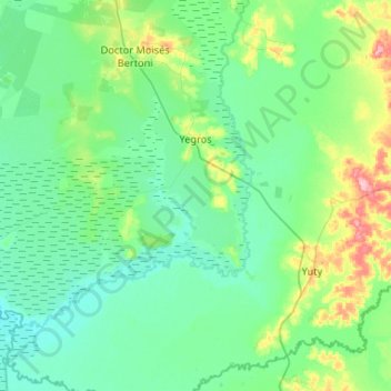
Name: Fulgencio Yegros topographic map, elevation, terrain.
Location: Fulgencio Yegros, Caazapá, Región Oriental, Paraguay (-26.68176 -56.84908 -26.36537 -56.32505)
Average elevation: 97 m
Minimum elevation: 74 m
Maximum elevation: 203 m
Other topographic maps
Click on a map to view its topography, its elevation and its terrain.
San Juan Nepomuceno
San Juan Nepomuceno, Caazapá, Región Oriental, Paraguay
Average elevation: 158 m
San Ignacio
Paraguay > Caazapá > San Ignacio
San Ignacio, Caazapá, Región Oriental, Paraguay
Average elevation: 119 m