
Oran Park topographic map
Interactive map
Click on the map to display elevation.
About this map
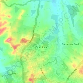
Name: Oran Park topographic map, elevation, terrain.
Location: Oran Park, Sydney, Camden Council, 2570, Australia (-34.02024 150.72268 -33.96026 150.76224)
Average elevation: 93 m
Minimum elevation: 61 m
Maximum elevation: 157 m
Other topographic maps
Click on a map to view its topography, its elevation and its terrain.