
Gwinnett County topographic map
Interactive map
Click on the map to display elevation.
About this map
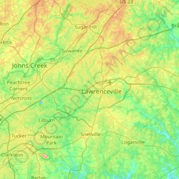
Name: Gwinnett County topographic map, elevation, terrain.
Location: Gwinnett County, Georgia, United States (33.75281 -84.27709 34.16787 -83.79910)
Average elevation: 302 m
Minimum elevation: 217 m
Maximum elevation: 513 m
Other topographic maps
Click on a map to view its topography, its elevation and its terrain.