
Château de Grouchy topographic map
Interactive map
Click on the map to display elevation.
About this map
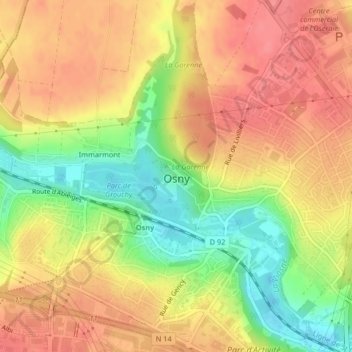
Name: Château de Grouchy topographic map, elevation, terrain.
Average elevation: 73 m
Minimum elevation: 31 m
Maximum elevation: 99 m
Other topographic maps
Click on a map to view its topography, its elevation and its terrain.
Immarmont
France > Île-de-France > Val-d'Oise > Osny > Immarmont
Immarmont, Osny, Pontoise, Val-d'Oise, Île-de-France, France métropolitaine, 95520, France
Average elevation: 78 m