
Moulton Seas End topographic map
Interactive map
Click on the map to display elevation.
About this map
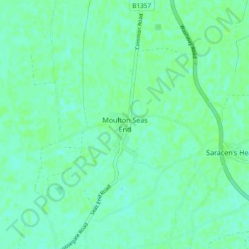
Name: Moulton Seas End topographic map, elevation, terrain.
Average elevation: 4 m
Minimum elevation: 0 m
Maximum elevation: 7 m
Other topographic maps
Click on a map to view its topography, its elevation and its terrain.
Spalding
United Kingdom > England > Lincolnshire > South Holland
Spalding, South Holland, Lincolnshire, England, United Kingdom
Average elevation: 4 m
Spalding Marsh
United Kingdom > England > Lincolnshire > South Holland > Weston CP
Spalding Marsh, Wykeham Farm, Weston CP, South Holland, Lincolnshire, England, PE12 6HE, United Kingdom
Average elevation: 4 m
Fleet
United Kingdom > England > Lincolnshire > South Holland
Fleet, South Holland, Lincolnshire, England, United Kingdom
Average elevation: 3 m
Low Fulney Estate
United Kingdom > England > Lincolnshire > South Holland > Spalding
Low Fulney Estate, Spalding, South Holland, Lincolnshire, England, PE12 6FQ, United Kingdom
Average elevation: 4 m
Risegate
United Kingdom > England > Lincolnshire > South Holland
Risegate, South Holland, Lincolnshire, England, PE11 4ET, United Kingdom
Average elevation: 4 m
Shepeau Stow
United Kingdom > England > Lincolnshire > South Holland > Whaplode Drove
Shepeau Stow, Whaplode CP, Whaplode Drove, South Holland, Lincolnshire, England, PE12 0UA, United Kingdom
Average elevation: 2 m
Spalding
United Kingdom > England > Lincolnshire > South Holland
Spalding, South Holland, Lincolnshire, England, PE11 1SR, United Kingdom
Average elevation: 4 m
Gedney
United Kingdom > England > Lincolnshire > South Holland
Gedney, South Holland, Lincolnshire, England, United Kingdom
Average elevation: 2 m
Donington CP
United Kingdom > England > Lincolnshire > South Holland
Donington CP, South Holland, Lincolnshire, England, United Kingdom
Average elevation: 3 m
Tongue End
United Kingdom > England > Lincolnshire > South Holland > Tongue End
Tongue End, Deeping St. Nicholas, South Holland, Lincolnshire, England, PE11 3JW, United Kingdom
Average elevation: 2 m
Sutton St. James
United Kingdom > England > Lincolnshire > South Holland
Sutton St. James, South Holland, Lincolnshire, England, United Kingdom
Average elevation: 2 m
Crossgate
United Kingdom > England > Lincolnshire > South Holland
Crossgate, South Holland, Lincolnshire, England, PE11 3XS, United Kingdom
Average elevation: 4 m
Surfleet CP
United Kingdom > England > Lincolnshire > South Holland
Surfleet CP, South Holland, Lincolnshire, England, United Kingdom
Average elevation: 4 m
Moulton
United Kingdom > England > Lincolnshire > South Holland
Moulton, South Holland, Lincolnshire, England, PE12 6GA, United Kingdom
Average elevation: 4 m
Holbeach CP
United Kingdom > England > Lincolnshire > South Holland
Holbeach CP, South Holland, Lincolnshire, England, United Kingdom
Average elevation: 3 m
Long Sutton
United Kingdom > England > Lincolnshire > South Holland
Long Sutton, South Holland, Lincolnshire, England, United Kingdom
Average elevation: 3 m
Gedney Hill
United Kingdom > England > Lincolnshire > South Holland
Gedney Hill, South Holland, Lincolnshire, England, PE12 0NN, United Kingdom
Average elevation: 2 m
Crowland
United Kingdom > England > Lincolnshire > South Holland
Crowland, South Holland, Lincolnshire, England, United Kingdom
Average elevation: 3 m
Pinchbeck CP
United Kingdom > England > Lincolnshire > South Holland > Pinchbeck CP
Pinchbeck CP, South Holland, Lincolnshire, East Midlands, England, United Kingdom
Average elevation: 4 m
Holbeach St Johns
United Kingdom > England > Lincolnshire > South Holland
Holbeach St Johns, South Holland, Lincolnshire, England, PE12 8RS, United Kingdom
Average elevation: 2 m
Quadring
United Kingdom > England > Lincolnshire > South Holland
Quadring, South Holland, Lincolnshire, England, PE11 4PJ, United Kingdom
Average elevation: 4 m
West Pinchbeck
United Kingdom > England > Lincolnshire > South Holland
West Pinchbeck, South Holland, Lincolnshire, England, PE11 3NN, United Kingdom
Average elevation: 4 m
Gosberton Clough
United Kingdom > England > Lincolnshire > South Holland
Gosberton Clough, South Holland, Lincolnshire, England, PE11 4JP, United Kingdom
Average elevation: 3 m
Whaplode Drove
United Kingdom > England > Lincolnshire > South Holland > Whaplode Drove
Whaplode Drove, South Holland, Lincolnshire, England, PE12 0TS, United Kingdom
Average elevation: 3 m
Weston CP
United Kingdom > England > Lincolnshire > South Holland
Weston CP, South Holland, Lincolnshire, England, United Kingdom
Average elevation: 3 m
Whaplode
United Kingdom > England > Lincolnshire > South Holland
Whaplode, South Holland, Lincolnshire, England, PE12 6TG, United Kingdom
Average elevation: 4 m
Gedney Drove End
United Kingdom > England > Lincolnshire > South Holland
Gedney Drove End, South Holland, Lincolnshire, England, PE12 9PG, United Kingdom
Average elevation: 4 m
Moulton Chapel
United Kingdom > England > Lincolnshire > South Holland
Moulton Chapel, South Holland, Lincolnshire, England, PE12 0XQ, United Kingdom
Average elevation: 3 m