
Wanze topographic map
Interactive map
Click on the map to display elevation.
About this map
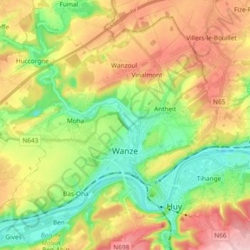
Name: Wanze topographic map, elevation, terrain.
Location: Wanze, Luik, Wallonië, 4520, België (50.50858 5.13217 50.58258 5.26584)
Average elevation: 142 m
Minimum elevation: 58 m
Maximum elevation: 252 m